7 stunning mountain hikes to try in South Korea
A trip to South Korea wouldn’t be complete without conquering – or at least exploring – one of its many majestic mountains.
South Korea’s landscape is dominated by mountains, with 70 percent of the country covered in towering peaks (the remaining 30 percent? Trendy coffee shops).
There are countless trails leading to the mountain summits, but there are also plenty of incredible hikes that don't necessarily reach the top.
Here are seven destinations where you can immerse yourself in vibrant fall colors or, later in the season, the serene white beauty of snow-capped peaks.
1. Seoraksan
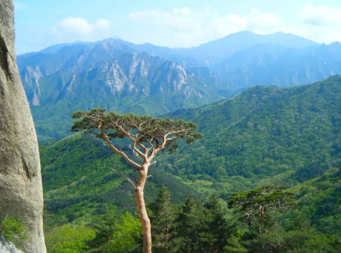
At 1,708 meters (about 5,600 feet), Daecheongbong is Seoraksan’s highest point and a popular destination for beginner hikers.
Depending on your starting point, the hike to the summit can be completed in as little as three hours. Lower down, the Cheonbuldong Valley bursts into brilliant colors during the fall season.
The two-hour hike to the top of Ulsan Bawi (876 meters) offers much more than just a good workout — it rewards you with stunning views of the eastern sea, Daecheongbong, and the valleys below.
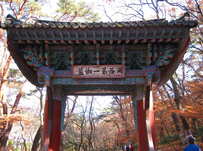
You can begin your journey from Sinheungsa, close to the Kensington Star Hotel. The vibrant colors typically last through late October.
Sinheungsa (신흥사); 170 Seorak-dong, Sokcho-si, Gangwon Province (강원도 속초시 설악동 170); +82 33 636 7700 (Seoraksan National Park Office)
2. Bukhansan
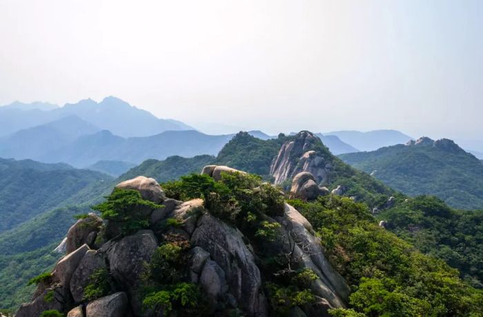
Amidst Seoul’s sprawling urban landscape, the city is home to seven mountains. However, Bukhansan, often called the 'lungs of Seoul,' stands out for its role in helping to clear the city’s air of CO2.
The three-hour hike up to Baegundae, the highest peak in Seoul (836 meters), begins at the Bukhansanseong Hiking Support Center near Gupabal Station (subway line 3), and is one of the most popular trails.
And for good reason: steep enough to keep you engaged, with stunning panoramic views of Seoul, this hike remains accessible even for casual weekend hikers.
Bukhansanseong Hiking Support Center (북한산성탐방지원센터); 62 Jingwang-dong, Eunpyeong-gu, Seoul (서울특별시 은평구 진관동 62); +82 357 9698 (Hiking Support Center); +82 2 909 0497 (Bukhansan National Park)
3. Taebaeksan
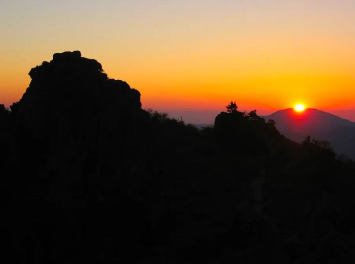
According to legend, Dangun, the founder of Korea’s ancient Goguryeo Kingdom, was born on Taebaeksan. At its 1,567-meter summit, Janggunbong, sits Cheonjedan, an ancient altar where sacred rites to honor the gods were once performed.
Taebaeksan truly comes alive in winter when its branches glisten with frost. In Korean, this breathtaking sight is known as “snow flowers.”
Autumn here is unfortunately often overlooked. While the colors may not be as bold as in other seasons, the mild weather makes for perfect hiking, and Taebaeksan’s leaves undergo their own transformation.
Despite its height, the ascent to Janggunbong is more of a gentle incline than a steep climb. The trek from the Baekdansa (Baekdan Temple) entrance takes no more than two hours.
Baekdansa entrance to Taebaeksan; 57-2 Mungoksodo-dong, Taebaek-si, Gangwon Province (강원도 태백시 문곡소도동 57-2); +82 33 552 7187 (Baekdansa); +82 33 550 2741 (Taebaeksan Provincial Park Office)
4. Songnisan
The key takeaway about Songnisan is that it’s an exceptionally beautiful mountain.
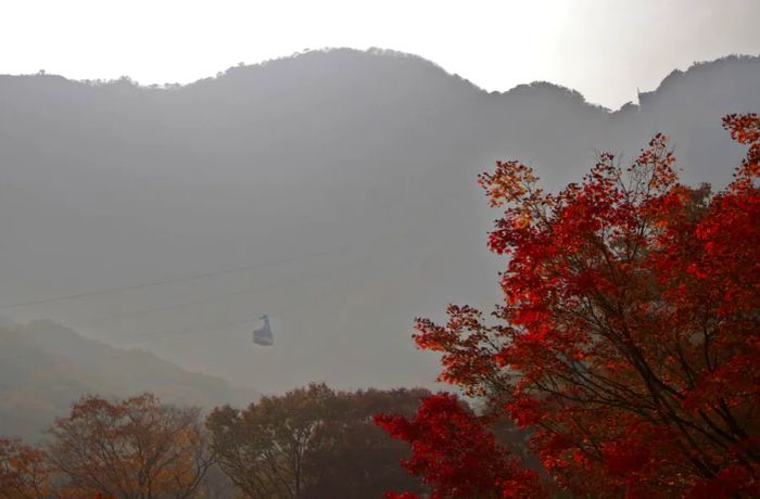
In autumn, the leaves turn various shades of scarlet, set against the striking and unique rock formations that define Songnisan’s cliffs.
The highest peak is Cheonwangbong at 1,058 meters, but the most enchanting spot is Munjangdae, just 1,054 meters high and often shrouded in clouds. The view from Munjangdae is breathtaking, and if you start at Beopjusa, the ancient Shilla-era temple, you can reach it in about three hours.
Tip: Beopjusa also offers a Temple Stay program, allowing you to ‘leave mainstream society’ for a bit longer than a hike. The temple is also home to the largest Buddha statue on the Korean peninsula, a 33-meter figure draped in gold leaf.
Beopjusa (법주사); 209 Sanae-ri, Songnisan-myeon, Boeun-gun, North Chungcheong Province (충청북도 보은군 속리산면 사내리 209); +82 43 542 5267 (Songnisan National Park)
5. Jirisan
Jirisan is the giant among South Korea’s mainland mountains. The park that stretches across its peaks is the country’s largest national park, covering 484 square kilometers. The highest point, Cheonwangbong (1,915 meters), is only surpassed by Hallasan in height.
For a true autumn experience, head to the valleys, where the vibrant colors linger longer. One of the most breathtaking spots is Piagol Valley to the south. You can start your journey at Yeongok Hiking Support Center and either complete the five-hour trek or take your time soaking in the views.
Valleys tend to see their fall foliage later than the mountaintops, so you can enjoy autumn colors a few weeks after they've faded higher up.
Yeongok Hiking Support Center; Naedong-ri, Toji-myeon, Gurye-gun, South Jeolla Province (전라남도 구례군 토지면 내동리); +82 55 972 7771 (Jirisan National Park Office)
6. Naejangsan
At first glance, Naejangsan may seem like an unlikely candidate for a list of South Korea's iconic mountains. With its highest peak, Sinseonbong, standing at just 763 meters, it doesn't quite measure up in terms of altitude.
However, Naejangsan's annual autumnal makeover is so spectacular that it has earned its reputation as the heart of fall foliage in South Korea for over 500 years.
The most popular route is a three-hour hike from the Hiking Information Center to Seoraebong peak, but the beauty begins long before you reach the summit.
On your way from the Hiking Information Center to Naejangsa Buddhist temple, you'll pass a stunning avenue of 108 trees, their branches heavy with a mix of golden, orange, and red leaves.
59-10 Naejang-dong, Jeongeup-si, North Jeolla Province (전라북도 정읍시 내장동 59-10); +82 63 538 7875 (Naejangsan National Park Office)
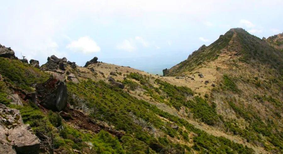
7. Hallasan
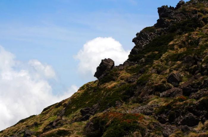
Hallasan, a towering volcanic mountain that dominates Jeju Island and stands as South Korea's highest peak at 1,950 meters, is primarily a winter attraction. However, its autumn beauty, along with the volcanic cones and lava flows that shape its landscape, is still well worth experiencing.
Many hikers begin their journey at Hallasan National Park’s Visitor Center and follow the Eorimok Trail, though this route doesn't reach the summit where the crater lake, Baeknokdam, awaits.
The Seongpanak Trail, starting from Seongpanak to the east, is a more demanding route. It takes about five hours to reach the lake, but the reward is worth the effort.
San 137-24, Gyorae-ri, Jocheon-eup, Jeju-si, Jeju Province (제주특별자치도 제주시 조천읍 교래리 산137-24); +82 64 710 4073 (Seongpanak Ticket Office); +82 64 713 9950 (Hallasan National Park Office)

1

2

3

4

5
Evaluation :
5/5