8 Must-See Hiking and Biking Trails in Lake Tahoe

In his semi-autobiographical work, Roughing It, Mark Twain described Lake Tahoe as “the fairest picture the whole earth affords.”
More than 150 years later, this statement remains true. Lake Tahoe glimmers like a sapphire sun nestled in the Sierra Nevada mountain range. Renowned for its remarkable clarity, the lake spans 191 miles and reaches depths of up to 1,645 feet. The surrounding landscape is equally enchanting, featuring forests, snow-capped peaks, lakes, streams, and meadows waiting to be explored.
The hiking trails around Lake Tahoe are perfect for soaking in the area's breathtaking beauty. From backcountry expeditions to wheelchair-friendly paths along the shoreline, here are our top picks for the best hikes in Lake Tahoe.
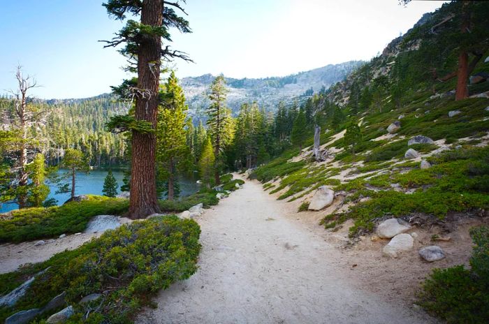
 The Angora Lakes Trail is a simple path leading to a picturesque beach © Matthew Peoples
1. Angora Lakes Trail
Perfect summer hike 1 mile round trip, 1 hour, easy
The Angora Lakes Trail is wide and sandy, mostly uphill, surrounded by towering trees and massive boulders that paint the scenery in greens, grays, and browns. As you reach the summit, Lower Angora Lake comes into view on your left. But don't stop there! While it’s lovely and peaceful, the real beauty lies ahead. Upper Angora Lake is breathtakingly stunning, framed by towering cliffs and dramatic rock formations. A stretch of soft sand makes for an ideal spot to lay out blankets or chairs for a relaxing day by the water.
From mid-June to mid-September, the historic Angora Lakes Resort offers kayak, SUP, and rowboat rentals, as well as a restaurant serving light bites like sandwiches and freshly squeezed lemonade. Arrive early since the parking lot ($10 per vehicle) fills up by 10 a.m. Remember to bring cash, as cards aren’t accepted.
 Grab some birdseed before heading to Chickadee Ridge © Wirestock / Getty Images
2. Chickadee Ridge
Ideal winter hike 2.4 miles round trip, 1.5 hours, moderate
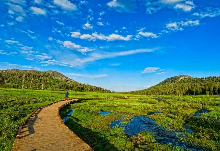
Chickadee Ridge is enchanting throughout the year, but it truly shines when blanketed in snow. The trail begins at the boardwalk in Tahoe Meadows, where a quaint bridge crosses the creek and leads you into the forest. Follow the signs to the Tahoe Rim Trail. Although it's an uphill trek, the stunning views of Lake Tahoe and the Sierra Nevada await you at the summit. While the vistas are a highlight, this hike is renowned for its friendly mountain chickadees, who delight in snacking from your hand (so be sure to pick up some birdseed first).
Tahoe Meadows is located 6.5 miles from Incline Village via Mt Rose Highway, with free parking available along the roadside. After a fresh snowfall, cross-country skis or snowshoes are recommended, although hikers will soon compact the snow. On most winter days, sturdy boots or waterproof shoes are sufficient, while a good pair of tennis shoes works well for the rest of the year.
 Lake Tahoe’s East Shore features a path designed to accommodate users of all abilities © 1000Photography / Shutterstock
3. Tahoe East Shore Trail
Best hike for strollers and wheelchair accessibility 6 miles round trip, 2 hours, easy
The Tahoe East Shore Trail, which is 10 feet wide and paved, was built to meet ADA (Americans with Disabilities Act) standards, allowing everyone to enjoy some of Lake Tahoe's most breathtaking views. This trail runs along the shoreline from Sand Harbor State Park to the Tunnel Creek Cafe in Incline Village, offering stunning vistas of Tahoe’s crystal-clear waters framed by the rugged Sierra Nevada peaks. Throughout the hike, you’ll find informative signs detailing the history of the indigenous Washoe people, as well as railroad, logging, and steamship heritage.
Parking at the trailhead in Incline Village is limited and paid. Alternatively, you can use TART Connect, North Lake Tahoe’s free, on-demand shuttle service for point-to-point transportation.
 Take your time to soak in the breathtaking sights along the Rubicon Trail © jennifer l stermer / Shutterstock
4. Rubicon Trail Hike
Ideal hike for camping 16.4 miles round trip, 7.5 hours, moderate
While it's possible to complete the Rubicon Trail in a single day, why rush when you can camp and awaken to some of Lake Tahoe's most stunning views? The trail meanders between Vikingsholm Estate at Emerald Bay State Park and DL Bliss State Park, captivating hikers with magnificent vistas of Fannette Island and Emerald Bay.
With its breathtaking scenery and striking rock formations, this area is a favorite for off-roading and dispersed camping. Facilities are minimal, so campers should plan to pack out everything they bring in. A free permit is necessary if you intend to have a fire.
 The Lake Tahoe Flume Trail offers an exceptionally picturesque biking experience © Stephanie Hager - HagerPhoto / Getty Images
5. Lake Tahoe Flume Trail
Top choice for mountain biking 14 miles round trip, 5.5 hours, moderate
Prepare to be amazed by the stunning views along the Lake Tahoe Flume Trail. Renowned as one of the most scenic mountain-biking trails globally, it offers captivating vistas of Lake Tahoe. Starting at Spooner Lake State Park, the initial 4 miles feature a steep ascent, so take breaks as needed. The narrow path is carved into granite, with sheer drops leading to the lake below, so exercise caution, particularly in slippery conditions. Typically, the trail is snow-free by Memorial Day.
 The Rainbow Trail is a family-friendly loop that accommodates strollers and wheelchair users © Ray Explores
6. Rainbow Trail
Ideal hike for families 0.5-mile loop, 15 minutes, easy
The picturesque Rainbow Trail in South Lake Tahoe is accessible for strollers and wheelchairs. Situated at the Taylor Creek Visitor Center on Hwy 89, this short paved trail features educational elements like a forest, wetlands, and a stream where salmon spawn in the fall, along with interpretive signage, a boardwalk, and a complimentary audio tour available in English, Spanish, and Washoe (the local indigenous language).
The visitor center usually operates from Memorial Day to the end of October, but the grounds are open for exploration year-round. In winter, the area becomes a favorite for cross-country skiing and snowshoeing.
 Secure your permit in advance to tackle the demanding Mount Tallac Trail © ddub3429 / Shutterstock
7. Mount Tallac Trail
Top hike for elevation gain 9.6 miles out and back, 5.5 hours, hard
Rising to 9,735 feet, Mt. Tallac is the highest peak overlooking Lake Tahoe. The panoramic views from the summit are breathtaking, but reaching them requires a significant effort. Located in Desolation Wilderness within the Eldorado National Forest, hikers must obtain a permit. The trail offers a challenging yet rewarding experience, featuring steep scrambles, lakes, streams, waterfalls, forests, and meadows. The vistas from the summit extend for miles, showcasing a spectacular landscape of sky, trees, mountains, and the stunning lake below.
While the summit of Mt. Tallac is primarily suited for seasoned hikers, the stunning scenery along the route makes it worthwhile, even if you don’t reach the peak.
 The Tahoe Rim Trail offers an epic multiday backcountry experience © iStockphoto / Getty Images
8. Tahoe Rim Trail
Ultimate hike for backcountry exploration 165-mile loop, 10–15 days, hard
Spanning 165 miles, the Tahoe Rim Trail is not a trek to complete in a single day. Many adventurers opt to segment the hike, returning annually to explore a new section. This loop trail features eight designated trailheads and includes a segment that passes through Desolation Wilderness. A permit is necessary for both hiking and camping in this area. Bear canisters are required here, but it's wise to carry them at all times to reduce encounters with wildlife.
The trail winds along the ridgeline overlooking the lake, meandering through a stunning wilderness of alpine lakes, forests, streams, and meadows. The breathtaking views of the rugged Sierra Nevada peaks plunging into the vibrant turquoise waters of Lake Tahoe create an unforgettable hiking experience, whether you tackle it all at once or in segments.

1

2

3

4

5
Evaluation :
5/5