Arctic Front Set to Disrupt Holiday Travel as Temperatures Drop

Forecasters are alerting the nation to the potential for hazardous holiday travel and life-threatening cold as an arctic air mass sweeps into the already chilly southern United States.
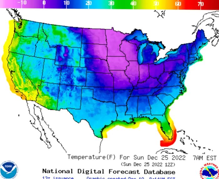
“We’re anticipating significantly below-average temperatures, with the possibility of record lows as we approach the Christmas holiday,” stated Zack Taylor, a meteorologist with the National Weather Service.
The approaching arctic front is expected to bring “extreme and prolonged freezing conditions to southern Mississippi and southeast Louisiana,” according to a special weather statement released by the National Weather Service on Sunday.
Provided by the National Weather Service
By Thursday night, temperatures are expected to plummet to around 13 degrees in Jackson, Mississippi, and about 5 degrees in Nashville, Tennessee, according to the National Weather Service.
For much of the United States, winter weather conditions are set to worsen before improvement arrives.
The upcoming week could bring “the coldest air of the season” as a powerful arctic front sweeps across the eastern two-thirds of the country in the days leading up to Christmas, according to forecasts from the federal Weather Prediction Center in College Park, Maryland.
The center cautioned of a “vast area of freezing temperatures stretching from the Northern Rockies and Northern Plains to the Midwest, reaching the Gulf Coast and much of the Eastern U.S. by Friday and into the weekend.”
No White Christmas in Florida, But Lows in the 20s
Florida may not see a white Christmas, but forecasters predict an unusually chilly weekend across the state.
Cities in northern Florida, including Jacksonville, Tallahassee, and Pensacola, are expecting lows in the 20s on Christmas Eve, with daytime highs around 40 degrees.
In Atlanta, temperatures are forecasted to dip below freezing early Monday morning, with even colder air moving in later in the week, as reported by the National Weather Service office in Peachtree City, Georgia. The low on Friday night is expected to be about 13 degrees, with Saturday's high remaining below freezing at around 29 degrees, according to projections from the Weather Service.
Frigid Temperatures Follow a Severe Winter Storm in the Northeast
The polar air mass moves in as a previous storm system winds down in the northeastern U.S., having dumped up to two feet of snow in some areas. Over 80,000 customers in New England remained without power on Sunday morning, according to poweroutage.us, which monitors outages nationwide.
Utility companies have deployed additional workers from other states but are facing challenges due to icy roads and hazardous conditions.
“This snow was heavy and wet, which affected both travel and infrastructure,” stated Frank Pereira, a meteorologist with the National Weather Service.
Police in New England dealt with hundreds of accidents or vehicles skidding off the road this weekend, with Maine State Police reporting over 180 crashes since Friday evening.
Officials in Vermont are identifying potential warming center locations in the most affected areas, should they be necessary. State officials cautioned on Saturday that some residents may face a wait of two to three days before power is restored.
“Last night, we had some guests who were unable to cook for themselves, so we ensured there was room for them,” said Becket Gourlay, a host at the Waterhouse Restaurant in Peterborough, New Hampshire, on Sunday. “Even today, we welcomed some patrons who came to watch the World Cup final because their TVs were out.”


Evaluation :
5/5