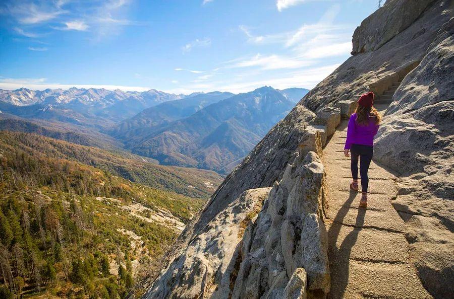
Top 12 Hikes in California: Embrace the Outdoors in the Golden State

If each state in the US had its own beauty pageant, California would undoubtedly be a top contender for the title.
With its stunning coastlines, towering granite peaks, rushing waterfalls, the tallest trees on Earth, crystal-clear lakes, and desert retreats, California boasts an incredible range of hiking trails, making it nearly impossible to pick favorites. Yet, we've managed to do just that.
We've explored well-known trails as well as hidden gems that take adventurers off the beaten path into serene wilderness, where diverse ecosystems and wildlife encounters await. Here are the finest hikes in California.
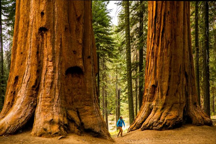
 Exploring the majestic redwoods and sequoias is a true California experience © Jordan Siemens / Getty Images
1. Boy Scout Tree Trail
Ideal hike for soaking in the beauty of redwood forests 5.5 miles round trip, 3–4 hours, moderate difficulty
Coast redwoods, the tallest trees on the planet, soar over 350 feet high and can live for more than a millennium. California is one of the rare places to witness their grandeur. While there are many trails through the redwoods, the Boy Scout Tree Trail remains a timeless favorite.
Although it's located in the remote northern reaches of Jedediah Smith Redwoods State Park, many visitors navigate the winding forest roads and vie for scarce parking at the trailhead. The chance to trek along this sometimes steep and uneven trail amidst the towering ancient giants makes it all worthwhile. On clear days, the sunlight streaming through the canopy creates a truly magical atmosphere.
2. Fern Canyon Trail
Top hike in Northern California 1.1 miles round trip, 1–2 hours, easy
This stunning location served as a filming site for Jurassic Park 2: The Lost World, and it’s easy to see why. The massive ferns climbing the walls of this expansive 80-foot canyon are impressively dinosaur-like, and the lush surroundings have earned it recognition as a World Heritage Site and International Biosphere Reserve.
Nestled in Prairie Creek Redwoods State Park, Fern Canyon tends to attract crowds during summer, and the parking lot, accessible via a dirt road through the woods, can quickly fill up. Be aware that the road may become impassable in winter. Wear water-friendly shoes, as the trail crosses a winding creek with pebbles, and your feet are likely to get wet.
3. Lassen Peak Trail
Top hike for mountain and volcanic scenery 5 miles round trip, 4–5 hours, moderate to challenging
California's hydrothermal gem, Lassen Volcanic National Park, is home to four different types of volcanoes, including the largest plug-dome volcano in the world. Standing at 10,457 feet, Lassen Peak last erupted less than a century ago and remains active today, attracting the most adventurous hikers.
Why tackle this hike? The breathtaking views of the entire Lassen area, showcasing landscapes shaped by past eruptions and adorned with pristine lakes, are just the beginning. The trail also presents rare alpine flora, patches of snow, and signs of glacial history. Despite the damage from the 2021 Dixie fire, this hike continues to impress.
 The Lost Coast Trail in California offers a true escape from the usual tourist routes © Corey Rich / Getty Images
4. Lost Coast Trail
Premier multi-day hike 24.6 miles one way, 3–4 days, challenging
During the construction of the Pacific Coast Highway, engineers chose to skip approximately 100 miles of rugged coastline, resulting in California's renowned Lost Coast. Dedicated hikers travel from across the globe to immerse themselves in the solitude and breathtaking landscapes of this remote shoreline, often embarking on multi-day treks through the King Range National Conservation Area.
For those who find long beach walks, tide management, and boulder scrambling intimidating, the Lost Coast also provides shorter and easier alternatives. The scenic trek from Mattole Trailhead to Punta Gorda Lighthouse, famous for its elephant seals, can be completed in half a day, while trails along the coastal bluffs in Sinkyone Wilderness State Park frequently feature Roosevelt elk sightings. Reaching any Lost Coast trailhead is an adventure in itself.
5. Lands End Trail
Top day hike 4.3 miles one way, 2 hours, moderate difficulty
The most captivating hike in San Francisco guides adventurers along the city’s northwestern coastline, presenting stunning views of the dramatic shore, the iconic Golden Gate Bridge, and the rugged Marin Headlands to the north. The trail meanders through wind-swept cypress trees, down charming staircases, across coastal bluffs, and along beach boardwalks. Enticing detours lead to picturesque overlooks and secluded coves.
History buffs will enjoy that this hike features Fort Point, a Civil War fort, and several WWII-era bunkers, including Battery Crosby, perched along the bluffs. Nearby are the Sutro Baths, a grand indoor swimming complex established in 1896. Imagine the Victorian gentry enjoying a splash in rented woolen swimsuits as you walk by.
6. Big Sur Trails in Andrew Molera State Park
Best coastal hike 2.3-mile beach loop, 2 hours, easy or 8.7-mile ridge loop, 4–5 hours, moderate
Big Sur embodies the essence of California’s dreaminess, so make sure to step out of the car and hike into this fairytale. Andrew Molera State Park offers everything – stunning ocean vistas, towering bluffs, hidden beaches, and even a hilltop grove of redwoods.
You have two options for exploration. The shorter, easier loop takes the Beach Trail to the roaring sea and returns via the Creamery Meadows Trail, winding through picturesque grasslands once grazed by dairy cows. For those seeking expansive, breathtaking coastal views and peaceful, shady forests, the longer route combines the Panorama Trail, Bluffs Trail, and Ridge Trail. A charming spur trail leads to a pristine, secluded beach.
 Hiking in California offers a rich tapestry of diverse and captivating landscapes © Zachary Miller / Getty Images
7. Rubicon Trail
Top lake hike 10 miles round trip, 4–5 hours, moderate difficulty
The iconic Tahoe hike, Rubicon Trail meanders along the forested southwest shoreline of the renowned lake, showcasing breathtaking views of its depth, clarity, and vibrant blue hue. Starting from the trailhead at DL Bliss State Park, the dirt path winds past pine trees and boulders, traversing coastal bluffs, descending into hidden coves, and eventually leading into the picturesque Emerald Bay State Park.
This remarkable trail is steeped in history as well. Many hikers opt for the mile-long detour to the stunning Vikingsholm Castle, a beautiful example of Scandinavian architecture. The trail also offers a fantastic view of Fannette Island, a small granite outcrop where, in the 1920s, widowed heiress Lora Knight would transport guests by boat to a charming teahouse.
8. Yosemite Falls Trails
Best hike for waterfalls 1-mile loop, 1 hour, easy or 7.2 miles round trip, 6–8 hours, challenging
Yosemite is a breathtaking realm of towering granite and cascading waterfalls, including North America’s highest waterfall: Yosemite Falls. Divided into upper and lower falls, hikers can choose a gentle, paved path leading to a footbridge near the base of the lower fall (which still boasts an impressive height of 320 feet!). From this vantage point, both falls provide stunning views, often accompanied by refreshing mist. The eastern section of the lower trail is accessible for wheelchairs.
Adventurous and fit hikers may prefer the trek to the top of Upper Fall, where the 2,425-foot summit offers breathtaking views of iconic granite formations like Half Dome and Sentinel Rock, as well as Yosemite Creek and the valley below. The ascent through oak woodlands, exposed plateaus, and challenging rocky terrain near the summit is strenuous but immensely rewarding. For those seeking further adventure, the trails continue to Yosemite Point or Eagle Peak.
9. Gem Lakes Trail
Best hidden hike 7.8 miles round trip, 5 hours, moderate
Many hikers miss out on California’s Eastern Sierra. However, the high alpine Little Lakes Valley is a must-visit destination, featuring a series of picturesque lakes framed by coniferous trees and backed by rugged, snow-capped granite peaks.
The trail runs alongside Rock Creek, where you might spot anglers fishing for trout, then descends into a glacier-carved valley, winding through meadows, crossing footbridges, and passing through lodgepole pines along the shores of shimmering blue lakes. Be sure to capture photos of the granite spires reflecting in the water when the opportunity arises.
Camping permits are mandatory for the John Muir Wilderness, and an overnight stay is highly recommended to fully appreciate the area.
10. Temescal Canyon Trail
Best hike in Los Angeles 3 miles round trip, 2 hours, moderate
The Temescal Canyon Trail is a favorite among locals in Los Angeles, often hiked multiple times a week for its stunning 360-degree views of the greater LA area, including the glamorous Hollywood Hills. The natural scenery is equally impressive, featuring climbable mountain peaks, a lush canyon, a stream bed lined with foxtail, and a bridge over a seasonal waterfall. Beyond the city skyline, the glimmering Pacific Ocean awaits.
Given its proximity to Pacific Palisades and Santa Monica, this popular hike tends to get quite crowded. For a less trafficked option, consider the detour to Skull Rock, a fascinating rock formation that offers its own breathtaking views.
11. Murray Canyon Trail
Best hike in Southern California 3.7 miles round trip, 2–3 hours, easy to moderate
Nestled within the Agua Caliente Indian Reservation at the base of the San Jacinto Mountains near Palm Springs, this hidden oasis trail feels almost surreal, as if a dream has materialized.
The trail begins flat, dotted with small boulders, yellow wildflowers, and the occasional sighting of a chuckwalla (a sizable lizard). Soon, hikers will reach a creek formed by melting snow, flanked by stunning fan palms. Makeshift log bridges span the creek as the path winds through an erosion-carved sandstone canyon, ultimately leading to a large pool nourished by a seasonal waterfall. Mule deer and bighorn sheep often come by for a drink.
12. Potato Chip Rock and Mt Woodson Trail
Best hike in San Diego 6.8 miles round trip, 4 hours, moderate
The charming Potato Chip Rock and Mt Woodson Trail near San Diego meanders around Lake Poway, passing through needle-like conifers and enormous metamorphic boulders, ascending countless stairs to reach a prime selfie location: a slender rock formation that resembles a potato chip.
The summit can get quite busy as visitors vie for the most outrageous photo with the iconic rock. Be patient and exercise caution; a fall from this spot could be around 20 feet. Keep an eye out for potential wildlife encounters, such as rattlesnakes and mountain lions lurking among the chaparral and scrub oak. Stay vigilant!

1

2

3

4

5
Evaluation :
5/5