Top Day Hikes in Banff National Park

Renowned for showcasing some of Canada's most breathtaking views—imagine vibrant blue lakes set against stunning snow-capped mountains—it's no wonder that Banff is the most popular national park in the country. Over four million visitors flock to the park each year, yet its vast network of 1600 km (1000 miles) of hiking trails allows you to escape the crowds with ease.
Many of the favored trails begin right from Lake Louise and the town of Banff, while others are conveniently reachable via the park's shuttle and transit services. Ranging from quick family-friendly walks to challenging full-day hikes, here are Banff’s top day hikes suited for all skill levels.
1. Vista Lake
Ideal one-hour hike 1.4 km (0.8 miles) one way; 60 to 90 minutes; easy
Lake Louise isn't the only breathtaking mountain lake in the area. You can spot the stunning blue-green Vista Lake right from the parking lot, but taking the short downhill walk to its shores is definitely worth it. Just remember, after enjoying the views, you’ll need to tackle a 120 m (400 ft) climb back to the parking area, so ensure your water bottle is filled.
If one hour feels too brief, extend your hike another 3.6 km (2.2 miles) down the trail to reach Arnica Lake. This rewarding trek involves a challenging 580 m (1900 ft) ascent along the Continental Divide, surrounded by blooming alpine wildflowers in summer and vibrant larch trees in autumn.
Start/finish: This out-and-back hike begins at the clearly marked Arnica Lake trailhead on Hwy 93, approximately 8 km (5 miles) south of Castle Junction on the south side of the road. The parking area is limited, so it's wise to arrive early, especially during the popular larch season in the fall.
2. Sunshine Meadows
Ideal for families 10 km (6 miles) of trail options available; 4 to 5 hours; easy to moderate
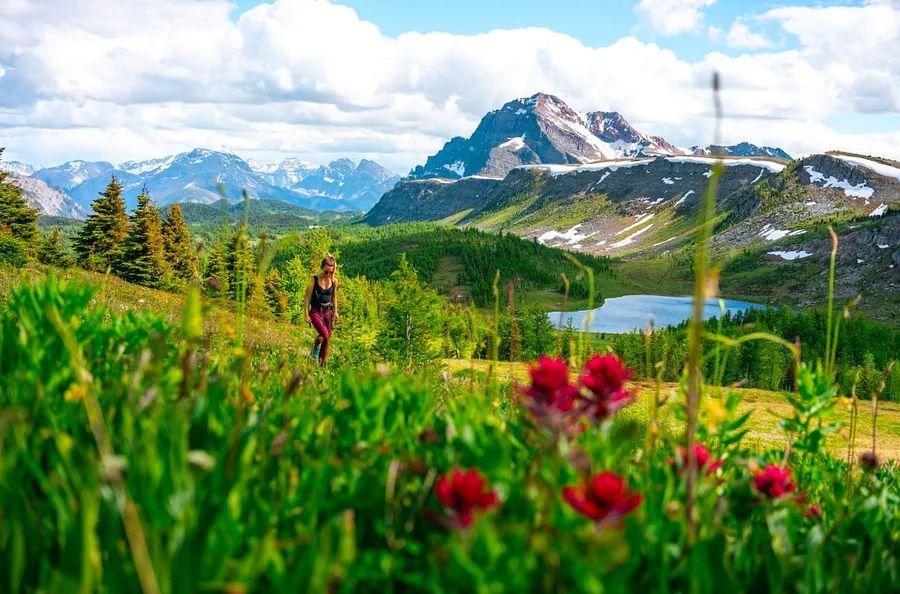
During the summer, Sunshine Village – one of Banff’s top ski resorts – becomes Sunshine Meadows: a family-friendly hiking paradise featuring over 10 km (6 miles) of trails to explore.
This location truly offers a choose-your-own-adventure experience, enhanced by a scenic gondola ride that takes you to the trailheads. (This means you can enjoy breathtaking heights without the uphill trek.) There are flatter trails suitable for younger kids, but the most popular path leads over the Continental Divide to a viewpoint at Rock Isle Lake.
Start/finish: Sunshine Village ski resort is located 8 km (5 miles) west of Banff on Hwy 1. A complimentary shuttle runs daily from the Banff townsite without requiring reservations. However, to access the hiking trails, a gondola ticket is necessary ($68 for adults; $19 for children) from early July to early September.
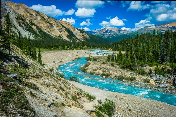
 The path to Bow Glacier Falls ranks among the best half-day hikes in Banff. Karl Johnson / Getty Images
3. Bow Glacier Falls
Ideal half-day hike 4.6 km (2.9 miles) one way; 3 hours round trip; moderate
What could be more mesmerizing than a Rocky Mountain alpine lake? A Rocky Mountain waterfall, of course. As you drive north of Banff towards Jasper on the Icefields Parkway (Hwy 93), you'll encounter numerous stunning waterfalls worth stopping for, but it’s essential to take a hike to reach some of the best.
Bow Glacier Falls is undoubtedly on that list, making this half-day hike a favorite among both locals and tourists. Formed from the melting Wapata Icefield that eventually becomes the Bow River (the same river that flows by the Fairmont Banff Springs), Bow Glacier Falls cascades down a steep rock face. This picturesque yet relatively straightforward trail (with only 155 m or 508 ft elevation gain) winds along the edges of Bow Lake before leading to the falls.
Start/finish: You can find the trailhead on Hwy 93, 36 km (22 miles) north of the Lake Louise junction, approximately 400 m (0.25 miles) down the Num-ti-jah Lodge access road.
4. Katherine Lake via Helen Lake
Top full-day hike 16.6 km (10.5 miles) round trip; 7 to 8 hours; moderate to challenging
The trek to Helen Lake – often hailed as one of the premier day hikes along the Icefields Parkway – is far from a secret. This breathtaking lake, located about 6 km (3.7 miles) down a moderate trail featuring a steady 455 m (1490 ft) elevation gain and a few small creek crossings, sits in a valley surrounded by wildflower meadows and majestic mountains.
If you still have energy to spare, continue along the trail following the signs to reach the much larger Katherine Lake. For more experienced hikers, a scrambling route leads to the summit of the towering 2993 m (9820 ft) Cirque Peak, providing stunning vistas of the surrounding lakes and glaciers.
Start/finish: The trailhead parking lot is located on Hwy 93, about 33 km (20 miles) north of the Lake Louise Junction, on the east side of the road across from the Crowfoot Glacier viewpoint. It's best to arrive early, as the parking area fills up quickly.
 Winter transforms Johnston Canyon into a stunning frozen wonderland. Matthew Skubis / Getty Images
5. Johnston Canyon
Top winter day hike 1.1 km (0.7 miles) one-way to the Lower Falls or 2.7 km (1.7 miles) one-way to the Upper Falls; 1 to 3 hours; easy
With its gentle slope and suspended walkways leading to both the lower and upper falls, Johnston Canyon is a favored hike throughout the year. However, it's during winter (from December to March) that the canyon transforms into a sparkling playground, featuring frozen waterfalls and ice formations that attract ice climbers.
Not keen on climbing an ice wall? The great news is you don't need an ice axe to enjoy this winter wonderland. Just put on some ice cleats or crampons, grab a pair of poles (available for rent at local outfitters in Banff, including Snowtips Backtrax), or join a guided tour with operators like Discover Banff Tours.
Start/finish: There are two parking lots at the Johnston Canyon day-use area located along Highway 1A, approximately 25 km (15.5 miles) west of Banff. Even in winter, these lots can fill up by midday, so plan your visit accordingly.
6. Peyto Lake Viewpoint
Top accessible hike 0.6 km (0.4 miles) one-way; 30 minutes round trip; easy
Looking for maximum reward with minimal effort? This 0.6-km (0.4-mile) walk leads to a viewing platform overlooking the stunning turquoise waters of Peyto Lake. A barrier-free 0.3-km (0.2-mile) trail from the upper parking lot makes it an excellent choice for those with limited mobility or wheelchair users.
Still have some energy left? Continue along the short nature trail, a 0.6-km (0.4-mile) loop that winds through the surrounding forest.
Start/finish: The trailhead is located on Hwy 93, approximately 40 km (25 miles) north of the Lake Louise junction at the Peyto Lake parking area.
 Venture beyond the Lake Agnes teahouse to escape the crowds on the breathtaking Big Beehive hike. Goofy79 / Getty Images
7. Big Beehive
Best for photographers 5 km (3.1 miles) one-way; 4 hours round trip, plus extra time for tea at the Lake Agnes teahouse; moderate
As you stroll along the northern shore of Lake Louise and start your ascent toward the Lake Agnes teahouse, you might wonder, “Didn’t Dinogo Planet promise a way to escape the crowds?” Just be patient. The first 3.4 km (2.1 miles) of this well-maintained path is among the busiest in Banff, with many hikers drawn the 385 m (1260 ft) uphill by the allure of freshly baked scones at the historic teahouse, which has been serving visitors since 1905.
However, once you pass the charming teahouse (open from June to October) and move behind Lake Agnes, the number of hikers drops significantly. From this point, it’s a mere 1.6 km (1 mile) via switchbacks to reach the summit of the Big Beehive. The reward? Breathtaking panoramic views of Lake Louise and the Fairmont Chateau Lake Louise below. This view is especially beautiful after a snowfall, but be cautious as the trail is prone to avalanches.
Start/finish: The Upper Lake Louise parking lot is located 4 km (2.5 miles) from the village of Lake Louise. Parking is limited (and not free), so unless you're leaving at 4 am, it's highly advisable to pre-book a shuttle if you're visiting between June and September.
8. Burgess Shale and Stanley Glacier Fossil Hike
Best for amateur geologists 10 km (6.2 miles) round trip with a 385 m (1260 ft) elevation gain; 8 hours; moderate
Although this moderately challenging hike isn’t located within Banff National Park, geology enthusiasts and dinosaur-loving kids will find the drive just past the Alberta-British Columbia border into Kootenay National Park worthwhile.
The Burgess Shale features remarkably preserved fossils from a shallow sea that existed around 508 million years ago, long before dinosaurs. After navigating through vibrant wildflower-filled forests, towering pines, and cascading waterfalls, you’ll reach the Stanley Glacier basin, where you can encounter trilobites, hyolithids, brachiopods, and sponges from the Eldon formation—many of which visitors are encouraged to touch. Not sure what any of that is? Don’t worry; Parks Canada staff will provide explanations during guided hikes ($80; reservations required).
Start/finish: The parking lot for Stanley Glacier is located 15 km (9.3 miles) south of Castle Junction along Hwy 93 in Kootenay National Park.
Tips for hiking in Banff National Park
Banff National Park hosts both black bears and grizzly bears. Always bring bear spray and know how to use it while hiking. You can rent bear spray from local outfitters in Banff, like Snowtips Backtrax, where staff are ready to help with instructions.
Make a lot of noise as you hike, but skip the bear bells. Their gentle chime is too soft to deter bears. Instead, experts suggest using loud sounds to notify bears of your presence. Clap or shout 'Hey bear!' around blind corners or in dense brush.
Elk are often seen around Banff and can be unpredictable, especially during spring calving and fall mating seasons. Always maintain a safe distance from them.
Stay hydrated. Banff is situated at about 1383m (4500ft) elevation, and if you're hiking, you’ll be going higher. If you're coming from a lower elevation, take a day or two to acclimatize before attempting more challenging trails. (Calgary, at 1045m or 3428ft, is a great and often budget-friendly place to adjust.)
If you're planning to hike at Lake Louise, expect the paid parking lot to fill up well before dawn. If you’re not an early riser, booking a shuttle in advance from Lake Louise or Banff is advisable. Similarly, Moraine Lake is accessible only by shuttle now.
Plan your hiking trip for July through September. In June, mountain passes may still be covered in snow or muddy from thawing. Always check trail conditions with Parks Canada before you head out.

1

2

3

4

5
Evaluation :
5/5