The 8 Top Hikes in Central America

In recent decades, countries like Costa Rica and Panama have turned Central America into a premier destination for adventure seekers.
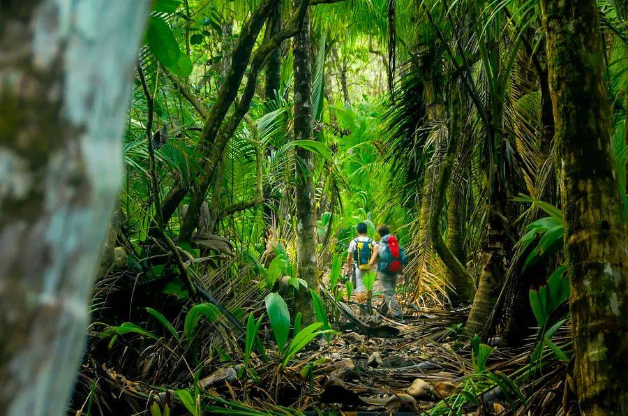
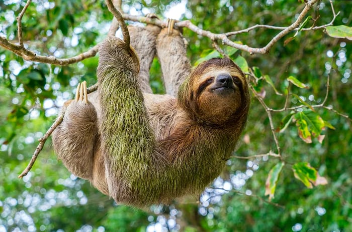
This region boasts smoking volcanoes, idyllic beaches dotted with palm trees, and lush jungles teeming with sloths and snakes.
This guide explores eight of the best hiking trails in the area, spanning from the wave-lashed Pacific coast to the remote Darien Gap. Its goal? To showcase Central America's top trekking routes and day hikes, catering to everyone from beginners to seasoned adventurers.
 Early birds have the greatest chance of encountering sloths on this hike in Costa Rica. Enrico Pescantini/Shutterstock
1. Sendero el Perezoso, Costa Rica
Ideal for sloth spotting1.3 km (0.9 miles), 30 minutes, easy
If you ask ten visitors why they chose Costa Rica, sloths will likely be mentioned by many. This brief detour off the main Park Trail in the biodiversity hotspot of Manuel Antonio National Park is designed for hikers eager to explore some of the most sloth-populated jungles in the world, which is reflected in its name.
The Sloth Trail starts less than a 10-minute walk from the main entrance of the reserve. Take the path leading west and follow the elevated boardwalks; soon you'll find yourself surrounded by towering silk cotton trees and buttonwoods.
While they are home to both two- and three-toed sloths, spotting these elusive creatures can be quite challenging—they hardly budge! Aim to start your hike early, as you'll find more sloths with fewer people around.
At the end of the trail, you'll reach the main junction for all routes in Manuel Antonio. It's an excellent spot, with the cinnamon sands of Playa Espadilla Sur on one side and the pathway leading to the picturesque powdery shores of Manuel Antonio Beach on the other.
 Volcán Concepción is one of two conical peaks that oversee Lago de Nicaragua. Alvaro Faraco/Getty Images
2. Volcán Concepción, Nicaragua
Ideal for an arduous full-day hike16km (9.9 miles), 11 hours, challenging
Volcán Concepción stands as one of two conical peaks overlooking Lago de Nicaragua, Central America's largest freshwater lake.
It may not seem like it, but you can tackle this hike in one go; just start early, as it typically takes 10 to 11 hours, and the cool morning air is a real advantage during the initial climb.
Regarding the climb, the main challenge lies in the altitude gain. The summit reaches a modest 1610m (5282ft), but you start from just 130m (427ft), making it quite a trek to the top. The first sections meander through vibrant jungle, followed by a winding muddy path that ascends the mountain's ridge.
The final stretch above 1200m (3937ft) becomes more demanding. Here, scree takes over, and there are steep sections where you might have to scramble against a dizzying backdrop of swirling lake waters and nearby coffee plantations.
The payoff is worth it: on clear days, the summit reveals a breathtaking view of a cloud-draped crater rim and even Mombacho Volcano to the north.
 The Lost Waterfalls Trail in Panama is one of the most frequented out-and-back hikes in Boquete. Martin Sarikov/500px
3. Lost Waterfalls Trail, Panama
Perfect for waterfall enthusiasts3.3km (2.1 miles), 2-3 hours, easy
The good news is that the three waterfalls on this hike aren’t truly lost; in fact, they are quite famous and are among the most sought-after spots in the eco paradise of Boquete.
However, they do feel somewhat hidden, as you'll have to navigate through dense jungles filled with lianas and spiderwebs to find them.
The waterfalls are spaced almost evenly along the trail. The first one is the largest, a powerful cascade that tumbles over a ridge of slick stone.
The second waterfall is perfect for swimming, cascading into a deep, dark plunge pool. The third resembles a scene from a Jules Verne novel, surrounded by lush vines and vibrant orchids deeper in the Panamanian rainforest.
There is an entry fee for the Lost Waterfalls Trail, plus you'll need a taxi from Boquete. Be sure to wear sturdy, waterproof boots and bring a rain jacket – it’s known to be muddy and wet throughout the hike.
 Traverse cloud forests filled with hummingbirds on this hike to Poás Volcano in Costa Rica. Sue Bishop/Shutterstock
4. Poás Volcano, Costa Rica
Best for an up-close view of a volcano4.6km (2.9 miles), 2.5 hours, moderate
Central America is dotted with more volcanoes than you can count on a hiking map, and one of the easiest to reach is Volcán Poás, located in the heart of north-central Costa Rica.
Nestled in a national park surrounded by jungle-clad peaks, Poás is located about 50 minutes north of Alajuela and a 90-minute drive from the capital, San José, making it an ideal destination for day trips.
At the trailhead, there's a visitor center where you can discover more about the intriguing vulcanology of Poás—despite its 40 eruptions since the 1820s, hikers continue to hit the trails.
The trail begins by heading east towards Laguna Botos, the first of two crater lakes, winding through cloud forests teeming with vibrant quetzals and hummingbirds.
The final climb leads you to a ridge at approximately 2500m (8202ft) elevation. Here, a stunning 180-degree view showcases the second crater lake, Laguna Caliente, which bubbles with sulfur and smoke within the Poás crater. Remarkably, it's the largest open crater in the world, stretching an impressive mile across.
5. Cerro Chirripó, Costa Rica
Ideal for experienced trekkers20km (12.4 miles), 2-3 days, challenging
Rising majestically above the sierras and clouds in southern Costa Rica, Cerro Chirripó is the tallest peak in the land of Pura Vida. This trek presents a genuine challenge that demands good fitness and perseverance, typically requiring two to three days on the mountain.
Reaching the trailhead itself is a trek, involving a journey through the Cordillera de Talamanca to the quaint trekking town of San Gerardo de Rivas.
From there, prepare for a full day of climbing steep, rocky trails until you reach the tin-roofed Crestones Base Camp. This is where the adventure intensifies, as day two features stretches of cloud forest and high-altitude paramo, characterized by rugged rosette plants and bright yellow wildflowers.
At the peak, soaring 3821m (12,536ft) above sea level, you can marvel at the surrounding lakes and glacial valleys that date back 20,000 years!
 Belize's Cockscomb Basin Wildlife Sanctuary is recognized as the forefront of jaguar conservation worldwide. Shutterstock
6. Tiger Fern Trail, Belize
Ideal for spotting jaguars5.5km (3.4 miles), 3-5 hours, moderate
If you can tear yourself away from the sugary sands of Belize's cays and atolls, a treasure trove of biodiversity awaits you inland. Among the numerous reserves, the Cockscomb Basin Wildlife Sanctuary stands out, featuring this moderately challenging out-and-back trail that winds through ancient jungles.
The Tiger Fern Trail winds through lush Belizean pine and broadleaf forests, occasionally crossing over a babbling creek on moss-covered stones. It takes you deep into jaguar-conservation territory, so stay alert for any signs of big cats along the way.
As you approach the summit, you'll find a rustic campground offering panoramic views of the Maya Mountains and two refreshing waterfalls perfect for cooling off.
The ideal time to visit is during the dry season (December to April), when the paths are typically less muddy and the plunge pools much clearer.
 It's advisable to get local guidance before you attempt to climb the highly active Volcán Telica. Svetlana Bykova/Shutterstock
7. Volcán Telica, Nicaragua
Best for camping near an active volcano13.1km (8.2 miles), 1-2 days, moderate
You can ascend Volcán Telica in León, northern Nicaragua, over the course of one or two days. The trek isn’t particularly difficult, beginning with flat agricultural land before transitioning to a steep climb up the volcano's winding cone. The real reward lies in the breathtaking views at the summit.
From the top, you’ll be treated to a sight reminiscent of the Nicaraguan Serengeti, stretching westward toward the Pacific, with vast scrublands sprinkled with the occasional mango tree and heat haze lingering low in the valley. The crater view is the highlight of the trip.
Gaze down into a smoking pit, spewing sulfur and wisps of ash. At night, when you might want to camp on the slopes, it glows red with molten magma and flowing lava.
8. Pipeline Trail, Panama
Best for immersing yourself in the jungle6.1 km (3.8 miles), 2.5-3 hours, moderate
The Pipeline Trail offers a straightforward trek through Bajo Mono, the hiking haven located just north of Boquete in western Panama.
Named after the industrial pipe that marks the trailhead, this path also represents the encroaching rainforest, which envelops you like a tunnel as you proceed. Indeed, the jungle surrounds you completely here.
A lush tapestry of greens and emeralds stretches above to the canopy, the air is rich with the scent of decomposing leaves, and you can sense the movement of snakes through the underbrush.
Out of nowhere, you'll be awestruck by the magnificent Cenizo – an enormous tree believed to be over a thousand years old. The grand finale features a cascading waterfall that tumbles through a cleft in the jungle-clad ridges above.

1

2
3

4

5
Evaluation :
5/5